Map #614837
Download map
PNG format
Full (2560x2560)
SVG format
Scalable vector (any size)
Licence
 Licenced under a Creative Commons Attribution 4.0 International Licence
Free to copy and distribute.
Free for commercial and non-commercial use, but you must credit.
Attribution example:
Image source: SuperMap.World
Unlock this map
Access high definition downloads and full-use licence (no attribution required).
Description
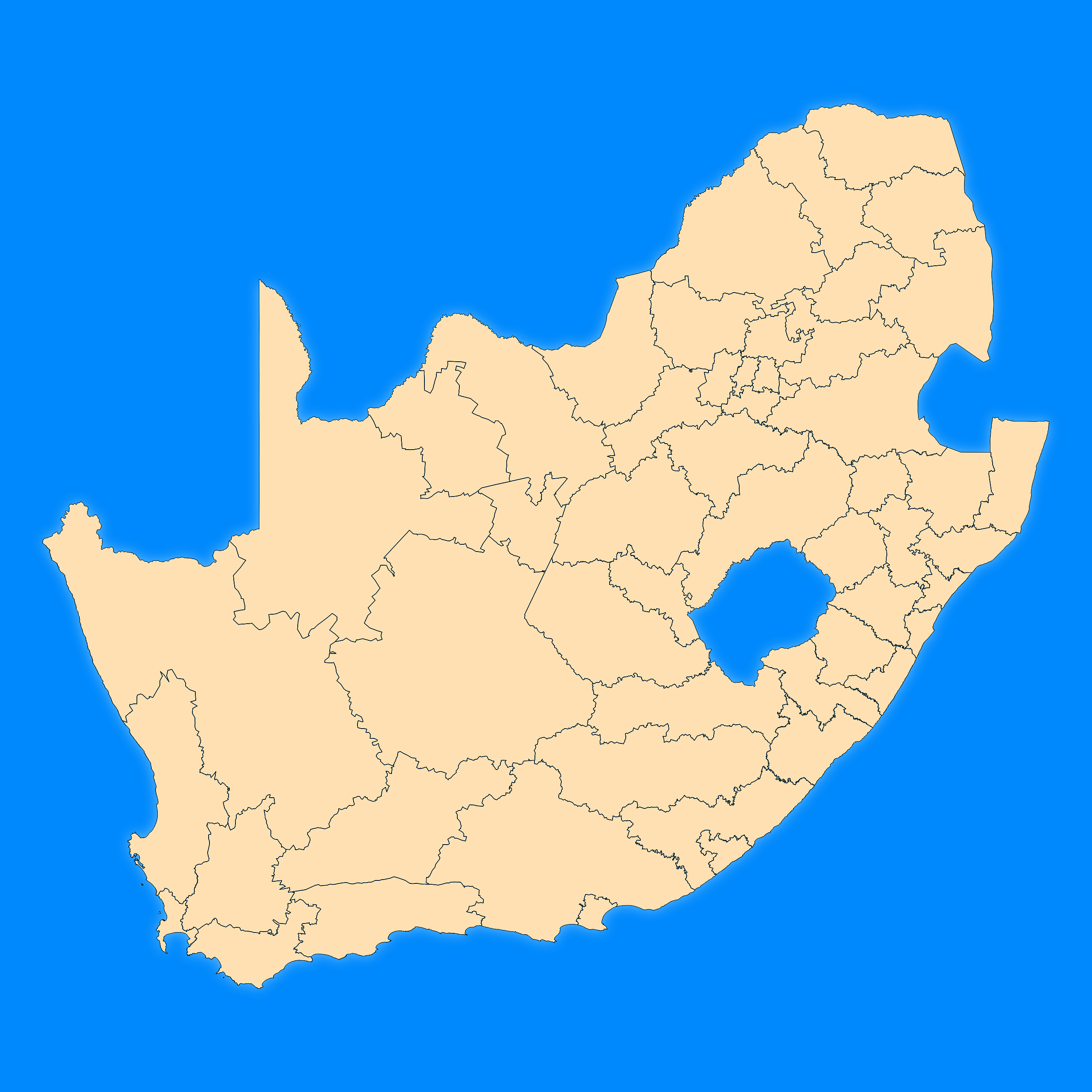
Mercator projection map of South Africa showing district municipality boundaries in blue and pastel amber
Projection
Location
Similar

#20703🇿🇦 South Africa

#52080🇿🇦 South Africa
#190732🇿🇦 South Africa

#266179🇿🇦 South Africa

#284731🇿🇦 South Africa

#327890🇿🇦 South Africa

#413675🇿🇦 South Africa

#684846🇿🇦 South Africa